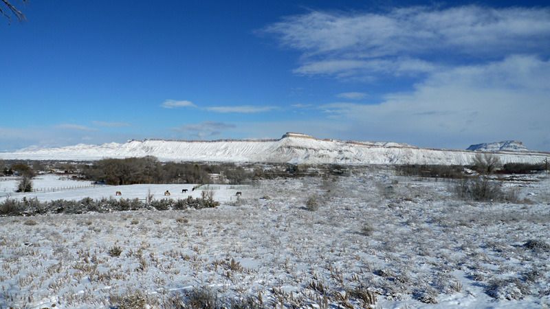
The Grand Valley is surrounded by mountains. The Grand Mesa is about ten miles from my house and about a 45 minute drive east from GJ to the top. It is the largest flat-topped mountain in the world with a high elevation of 11,332'. It has over 300 lakes, forest roads and trails for four wheeling, snowmobiling, cross country skiing, the Powderhorn ski area and resorts, cabins and campgrounds. On the north about 6 miles from my house is Mount Garfield and the Bookcliffs that sweep north and west into Utah. The south facing slopes appear barren but just beyond is juniper and pinyon forest with endless BLM land and backcountry roads. To the west is the red rock country of the Colorado Plateau that extends to Moab along the Colorado River, the cliffs and arches of Rattlesnake Canyon, the Colorado National Monument and south from Pinon Mesa to the Uncompaghre Plateau, all "decent" mountains with pinyon-juniper to Gambel oak in the shrub belt and higher elevation spruce-fir forest.Originally Posted by hurley842002

The Gunnison and Colorado Rivers are great for river running. I've traveled by canoe and kayak from the Black Canyon of the Gunnison to the Colorado River 109 miles to Westwater, UT, and shorter portions of it many times. No one will lack for outdoors opportunities here.
The Grand Valley is dry of snow now but these pics are from my computer desk at home looking east to the Grand Mesa and north to the Bookcliffs. The wide angle lens makes the mountains appear about twice as far away than they are.

Colorado AR-15 Shooters Club Discussion Forums
Welcome to the Colorado AR-15 Shooters Club Discussion Forums.


 Reply With Quote